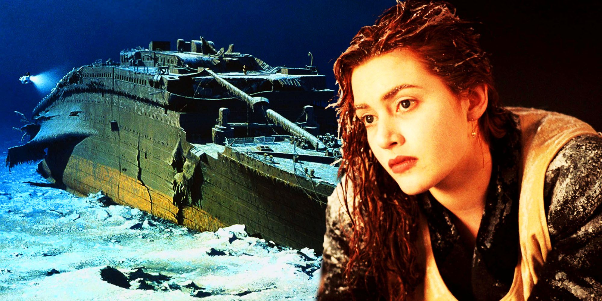
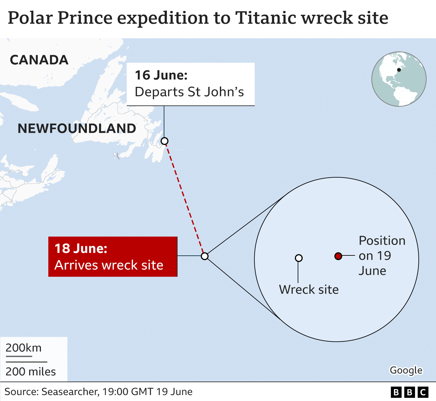
The RMS Titanic wreck is located in the North Atlantic Ocean, approximately 370 miles (600 kilometers) south-southeast of Mistaken Point, Newfoundland. It rests on the seabed at a depth of roughly 12,500 feet (3,800 meters). The bow section is positioned at coordinates 41°43′57″N 49°56′49″W, while the stern lies about 2,000 feet (600 meters) to the south.
Precise Geographic Coordinates and Position
Understanding the location of the RMS Titanic requires a distinction between the ship’s reported distress position and its actual resting place. On the night of April 14, 1912, the Titanic's navigators calculated a CQD/SOS position that was later found to be nearly 13 miles off from where the wreck actually lies. This discrepancy was one of the primary reasons the wreck remained undiscovered for 73 years.
The wreck is situated on the North Atlantic’s abyssal plain, a relatively flat but sediment-heavy region. Specifically, it lies on the continental rise in a region known as the Titanic Canyon. This area is characterized by slow-moving but powerful deep-sea currents that have influenced how the ship's remains have settled over more than a century.
As of 2026, the location is internationally recognized and monitored. The two main sections of the ship—the bow and the stern—are separated by a massive debris field. The bow, which remains the most recognizable part of the vessel, points toward the northeast. The stern, which suffered catastrophic structural failure during the sinking, is located at 41°43′35″N 49°56′54″W. These coordinates serve as the baseline for all modern scientific expeditions and salvage-rights monitoring.
The Depth and Environmental Conditions of the Site
The Titanic rests at a depth of approximately 2.37 miles. To put this into perspective, the water pressure at this depth is roughly 380 atmospheres (about 5,600 pounds per square inch). This extreme environment presents significant challenges for both robotic and manned exploration. In 2026, despite advancements in submersible technology, reaching this depth remains a high-risk endeavor requiring specialized titanium or carbon-fiber pressure hulls.
The temperature at the wreck site hovers just above freezing, typically between 0°C and 1°C (32°F to 34°F). This constant cold has, in some ways, helped preserve the steel, but it also supports a unique ecosystem of extremophiles. The most famous of these is the bacteria Halomonas titanicae, which consumes the iron of the hull, creating the iconic "rusticles" that drape over the ship’s railings and portholes.
Visibility at this depth is naturally zero. Total darkness prevails, meaning all visual documentation must be conducted with high-powered LED arrays mounted on Remotely Operated Vehicles (ROVs) or Autonomous Underwater Vehicles (AUVs). The lack of light also means there is no photosynthesis, yet the wreck has become an artificial reef for deep-sea corals, anemones, and scavenging fish that rely on marine snow—organic detritus falling from the surface.
Historical Discovery and the Search for the Wreck
The Titanic wreck location was officially identified on September 1, 1985, by a joint French-American expedition led by Dr. Robert Ballard of the Woods Hole Oceanographic Institution (WHOI) and Jean-Louis Michel of IFREMER. The discovery was the culmination of decades of failed attempts by various teams, some of which used magnetometers and side-scan sonar without success.
Ballard’s successful strategy involved searching for the debris field rather than the hull itself. Using the towed underwater camera sled Argo, the team followed a trail of coal and smaller artifacts that eventually led them to one of the ship’s massive boilers. This "trail of breadcrumbs" approach proved that the ship had broken apart before reaching the bottom, a fact that had been debated by survivors for decades.
The discovery fundamentally changed maritime archaeology. It transitioned the Titanic from a historical mystery into a physical site for forensic study. Since 1985, numerous expeditions have visited the site, including those led by James Cameron and various salvage companies. Each mission has added to our understanding of the wreck's orientation and the physics of high-speed deep-sea impacts.
The Debris Field and Structural Layout
The Titanic's final resting place is not a single pile of wreckage but a sprawling archaeological site covering approximately 15 square miles. The separation of the ship into two primary pieces occurred as the hull reached its breaking point at the surface. As the bow and stern descended, they behaved differently due to their hydrodynamic shapes.
The Bow Section
The bow is the most intact portion of the ship. Because it was filled with water as it sank, it did not implode. It hit the bottom at a relatively shallow angle, plowing into the mud and remaining upright. In 2026, while the mast has collapsed and the Captain’s quarters are deteriorating rapidly, the bow still retains the majestic silhouette of the "Queen of the Ocean."
The Stern Section
The stern suffered a much more violent fate. As it sank, trapped air caused massive implosions within the decks. It descended in a corkscrew motion, shedding large pieces of steel and heavy machinery. It struck the seabed with incredible force, resulting in a mangled heap of twisted metal that is almost unrecognizable to the untrained eye.
The Central Debris Field
Between these two sections lies a vast field of artifacts. This area contains everything from the ship’s massive leaded-glass windows and brass light fixtures to personal effects like leather shoes and suitcases. Because leather is treated with tannins that deep-sea organisms find unpalatable, shoes often remain where their owners' bodies once lay, serving as somber markers of the human cost of the tragedy.
Modern Mapping and the 2022-2023 Digital Twin
In recent years, the most significant development regarding the Titanic wreck location has been the creation of a "Digital Twin." In 2022, the deep-sea mapping company Magellan, in partnership with Atlantic Productions, conducted the largest underwater scanning project in history. Using AUVs, they captured over 700,000 images from every angle of the wreck.
This data resulted in a 3D photogrammetric model so detailed that individual serial numbers on the propellers and unopened champagne bottles in the debris field are visible. For researchers in 2026, this digital model is arguably more important than the physical wreck itself. As the ship continues to collapse due to bacterial consumption and ocean currents, the digital twin preserves the site in its current state for future generations of historians and engineers.
This mapping has also allowed for a more precise understanding of the site's "footprint." We now know exactly how the heavy engines settled and can trace the path of the debris with centimeter-level accuracy. This data helps scientists predict which sections of the wreck are likely to collapse next, such as the iconic bridge or the gymnasium.
Site Specifications and Environmental Data
The following table summarizes the key physical and geographic data for the Titanic wreck site as recognized in 2026.
| Feature | Specification |
|---|---|
| Primary Coordinates (Bow) | 41°43′57″ N, 49°56′49″ W |
| Primary Coordinates (Stern) | 41°43′35″ N, 49°56′54″ W |
| Average Depth | 3,800 meters (12,500 feet) |
| Distance from Land | ~600 km (370 miles) SE of Newfoundland |
| Water Pressure | ~380 bar (5,500+ psi) |
| Bottom Temperature | 0°C to 1°C (32°F to 34°F) |
| Debris Field Area | ~15 square miles (39 sq km) |
| Jurisdiction | International Waters (protected by UNESCO & US-UK Treaty) |
Legal Protection and Access in 2026
The Titanic wreck location is not owned by any single nation, as it lies in international waters. However, it is protected by several layers of international law and bilateral agreements. The most significant of these is the UNESCO Convention on the Protection of the Underwater Cultural Heritage. Additionally, a 2020 treaty between the United States and the United Kingdom grants both nations the authority to license or deny entry into the wreck's hull or the removal of artifacts.
RMS Titanic Inc. (RMST) holds the exclusive salvage rights to the wreck, granted by a U.S. federal court. While they have recovered thousands of artifacts for museum display, they are prohibited from "cherry-picking" items for private sale. In 2026, the focus of the legal community remains on the balance between "in situ" preservation (leaving everything where it is) and the recovery of items of high historical value before they are lost to decay.
Visitor access has changed significantly following the 2023 Titan submersible tragedy. In 2026, commercial tourism to the Titanic site is heavily regulated and restricted. Most missions to the site are now strictly scientific or educational, requiring rigorous safety certifications and redundant hull integrity monitoring. The site is treated with the reverence of a mass grave, as it remains the final resting place for over 1,500 people.
Current Status and the Future of the Wreck
The Titanic is a disappearing landmark. Biological activity is the primary driver of this decay. The Halomonas titanicae bacteria are estimated to consume hundreds of pounds of iron daily. Scientists have observed the rapid disintegration of the upper decks, including the disappearance of the Captain's bathtub and the collapse of the officer’s quarters.
By 2026, the structural integrity of the bow has reached a critical tipping point. Expert consensus suggests that within the next few decades, the ship's internal supports will give way, causing the decks to pancake on top of one another. Eventually, the Titanic will be reduced to a "rust stain" on the Atlantic floor, leaving behind only the non-biodegradable elements like the heavy bronze propellers, the lead plumbing, and the ceramic tiles.
Because of this inevitable decay, the current priority for oceanographers is non-invasive documentation. The use of high-resolution sonar and 4K video allows for "virtual salvage," where the ship's history is extracted without physically disturbing the site. This approach respects the legal protections while ensuring the story of the Titanic remains accessible as the physical wreck returns to nature.
FAQs About the Titanic Wreck Location
Is the Titanic wreck visible from the surface?
No, the Titanic wreck is absolutely not visible from the surface. It lies 12,500 feet below the ocean, far beyond the reach of sunlight (which only penetrates about 3,000 feet). Even with the most advanced surface-based sonar, the ship appears only as a small anomaly on the seabed.
Can you see the Titanic using Google Earth?
While you can see a marker and some low-resolution 3D renderings of the Titanic on Google Earth at its known coordinates, you cannot see live or actual satellite imagery of the wreck. Satellites cannot see through two miles of water; the "imagery" provided in digital maps is a reconstruction based on bathymetric sonar data.
Why wasn't the Titanic found sooner?
The ship was not found until 1985 because the ocean is vast, and the reported sinking coordinates were incorrect by over 13 miles. Additionally, the technology required to scan and photograph the seafloor at such extreme depths did not exist in a reliable form until the mid-1980s.
Is it possible to raise the Titanic?
No, it is not physically possible to raise the Titanic. The steel is too brittle and infested with bacteria; any attempt to lift the hull would result in it crumbling into pieces. Furthermore, the weight of the water-logged silt and the sheer scale of the ship make such an engineering feat impossible with current technology.
Who has the right to visit the wreck site?
In 2026, any expedition intending to interact with the wreck must comply with the US-UK treaty and UNESCO guidelines. While "sailing over" the site in international waters is technically allowed under the freedom of the high seas, any submersible activity that touches or enters the wreck is subject to strict legal oversight and permitting processes.
Are there still bodies at the Titanic location?
While most organic human remains (flesh and bone) were consumed by sea life or dissolved by the acidic nature of deep-sea water decades ago, the site is still considered a cemetery. The presence of pairs of shoes lying together suggests the locations where victims came to rest, and as a result, the site is treated with extreme solemnity.
Practical Recommendations for Researchers
For those interested in the current status or precise mapping of the Titanic wreck location, the most reliable resources are the official archives of the National Oceanic and Atmospheric Administration (NOAA) and the Woods Hole Oceanographic Institution (WHOI). These organizations maintain the most accurate bathymetric data and historical records of expeditions.
If you are a student or educator, it is recommended to utilize the "Digital Twin" models created during the 2022 Magellan scan. These provide a more comprehensive view of the site than any individual photograph could offer. Always verify coordinates through official maritime charts, as informal sources often confuse the 1912 SOS position with the actual 1985 discovery site.