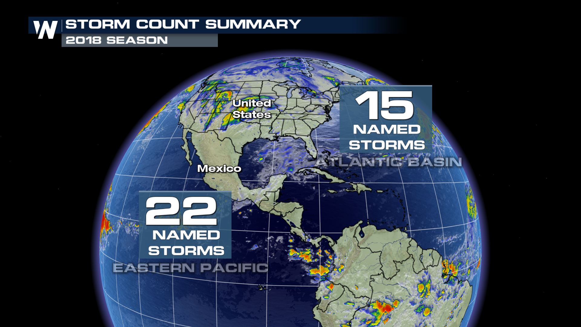
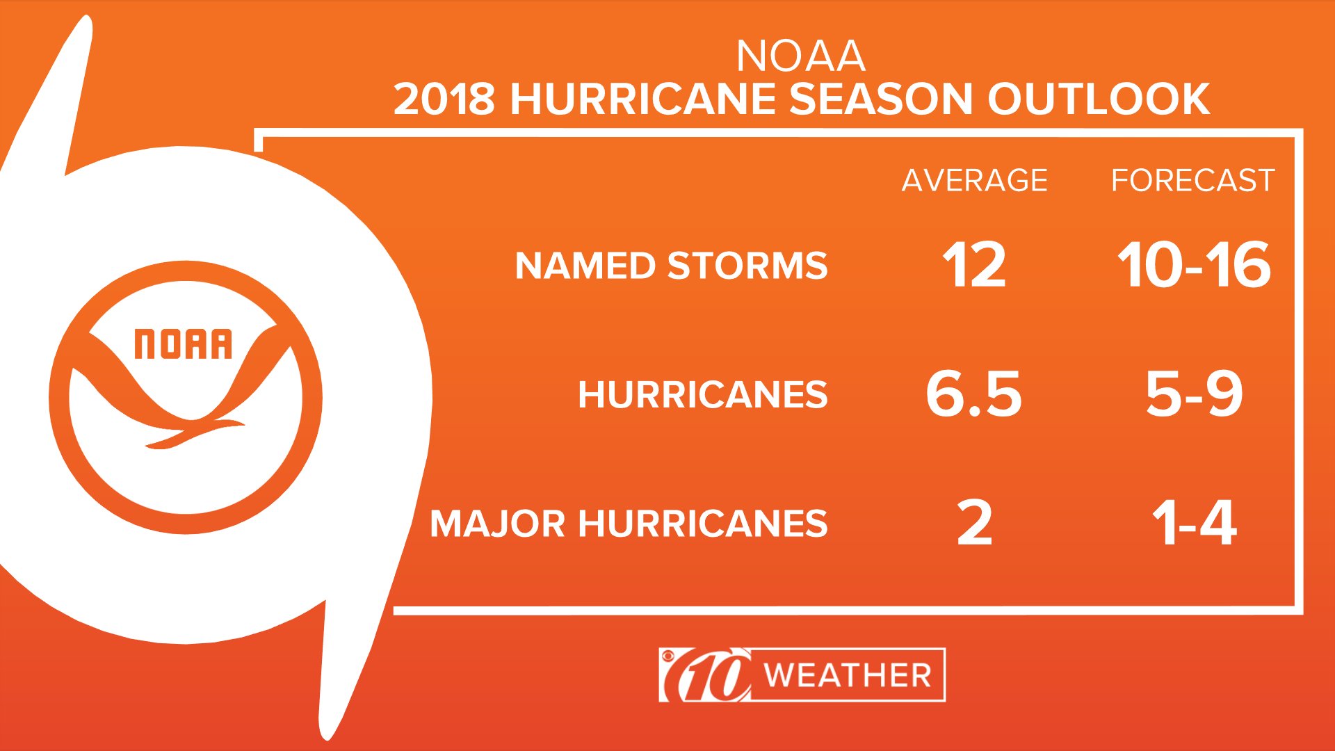
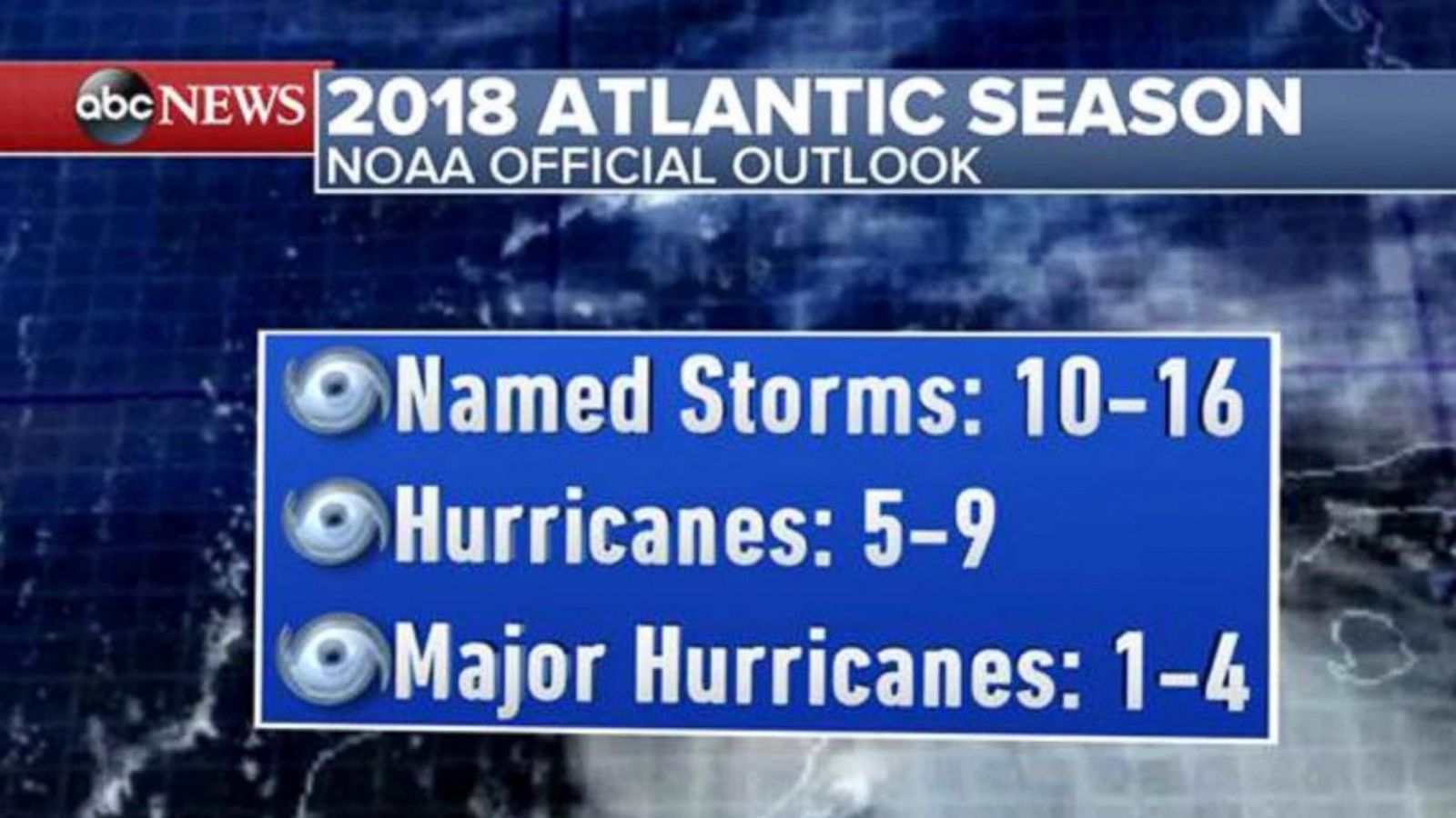
The 2018 Atlantic hurricane season was an active, above-average year characterized by 15 named storms, 8 hurricanes, and 2 major hurricanes. It is defined by the catastrophic landfalls of Hurricane Florence and Hurricane Michael, which collectively caused over $50 billion in damages and led to the retirement of both names from the rotating list.
Overview of the 2018 Hurricane Season Dynamics
The 2018 Atlantic hurricane season officially ran from June 1 to November 30, 2018, though activity began early with the formation of Tropical Storm Alberto in late May. By the time the season concluded, the Atlantic basin had produced a total of 15 named storms. This was significantly higher than the long-term historical average, continuing a trend of heightened activity in the North Atlantic.
From a meteorological standpoint, the season was a complex interplay between competing climate factors. Early in the year, forecasters monitored the potential development of El Niño, a climate pattern in the Pacific that typically increases vertical wind shear in the Atlantic, thereby suppressing hurricane formation. However, El Niño did not fully manifest until very late in the year, leaving a window of opportunity for tropical systems to develop in an environment of low shear and anomalously warm sea surface temperatures (SSTs) in the subtropical Atlantic.
The Accumulated Cyclone Energy (ACE) index for 2018—a measure used by the National Oceanic and Atmospheric Administration (NOAA) to express the activity of individual tropical cyclones and entire hurricane seasons—was approximately 129. This value sits well above the 1981–2010 median of 92, classifying the season as "above normal."
Statistical Summary of Named Storms
The season’s 15 named storms showcased a wide variety of behaviors, from short-lived subtropical systems to record-breaking major hurricanes. While the "major" hurricane count (Category 3 or higher on the Saffir-Simpson scale) was only two, the sheer intensity and specific landfall locations of those two storms made 2018 one of the most impactful years in recent memory.
2018 Atlantic Storm Breakdown
| Storm Name | Peak Intensity | Max Sustained Winds | Impacted Areas |
|---|---|---|---|
| Alberto | Subtropical Storm | 65 mph | Cuba, Florida, Gulf Coast |
| Beryl | Category 1 Hurricane | 80 mph | Lesser Antilles, Hispaniola |
| Chris | Category 2 Hurricane | 105 mph | Bermuda, Atlantic Canada |
| Debby | Tropical Storm | 50 mph | Open Atlantic |
| Ernesto | Tropical Storm | 45 mph | Ireland, United Kingdom (post-tropical) |
| Florence | Category 4 Hurricane | 150 mph | Carolinas, Mid-Atlantic |
| Gordon | Tropical Storm | 70 mph | Florida, Gulf Coast |
| Helene | Category 2 Hurricane | 110 mph | Cabo Verde, United Kingdom (post-tropical) |
| Isaac | Category 1 Hurricane | 75 mph | Lesser Antilles |
| Joyce | Tropical Storm | 50 mph | Open Atlantic |
| Kirk | Tropical Storm | 65 mph | Lesser Antilles |
| Leslie | Category 1 Hurricane | 90 mph | Bermuda, Madeira, Portugal |
| Michael | Category 5 Hurricane | 160 mph | Central America, Florida Panhandle, Georgia |
| Nadine | Tropical Storm | 65 mph | Open Atlantic |
| Oscar | Category 2 Hurricane | 110 mph | Open Atlantic |
Hurricane Florence: The Record-Breaking Flood
Hurricane Florence was the first major hurricane of the season, reaching Category 4 strength over the open Atlantic. While its wind speeds dropped to Category 1 before its landfall near Wrightsville Beach, North Carolina, on September 14, its physical size and slow forward motion created a historic disaster.
The Phenomenon of Stalling
The primary reason Florence was so destructive was a breakdown in the steering currents. A high-pressure ridge to the north of the storm essentially blocked its path, causing the hurricane to stall over the Carolinas for several days. When a tropical system stalls over land, the primary threat shifts from wind to rainfall. Florence dropped more than 30 inches of rain in parts of North Carolina, shattering state records for tropical cyclone rainfall.
Inland Flooding and Infrastructure Failure
The resulting freshwater flooding was catastrophic. Rivers reached record crests, and thousands of residents were displaced. The National Hurricane Center (NHC) reported that the storm was responsible for 52 deaths and approximately $24 billion in damage. Beyond residential destruction, the flooding caused significant environmental concerns due to the overflow of coal ash ponds and hog lagoons, highlighting the vulnerability of industrial infrastructure to extreme weather events.
Hurricane Michael: A Rare Category 5 Landfall
If Florence was defined by water, Hurricane Michael was defined by wind. Michael was a late-season storm that formed in the Caribbean and underwent rapid intensification—a process where a storm's maximum sustained winds increase by at least 35 mph in a 24-hour period.
Landfall and Intensity
On October 10, 2018, Michael made landfall near Mexico Beach and Tyndall Air Force Base in the Florida Panhandle. Initially classified as a Category 4, a post-season re-analysis by NOAA upgraded Michael to a Category 5 hurricane, with sustained winds of 160 mph. This made it the first Category 5 hurricane to strike the contiguous United States since Hurricane Andrew in 1992.
Devastation in the Florida Panhandle
The impact was near-total destruction in the immediate landfall zone. Mexico Beach suffered a devastating storm surge of 9 to 14 feet, while the wind flattened entire forests of timber and severely damaged Tyndall Air Force Base. Michael continued inland as a powerful hurricane, causing unprecedented damage to the agricultural sector in Georgia, particularly affecting cotton and pecan crops. The total economic toll of Hurricane Michael was estimated at $25 billion.
Unusual Activity and Technical Milestones
The 2018 season was also notable for its "weird" storms and the use of advanced meteorological technology.
Hurricane Leslie’s Long Journey
Hurricane Leslie was one of the most erratic storms in Atlantic history. It spent weeks wandering the central Atlantic, transitioning between subtropical and tropical characteristics multiple times. Remarkably, Leslie ended its life cycle by making landfall in Portugal as a powerful post-tropical cyclone, bringing hurricane-force winds to a region that rarely sees such activity.
The Role of GOES-16
2018 was the first full year that meteorologists had access to the high-resolution data from the GOES-16 (GOES-East) satellite. This technology provided imagery every 30 to 60 seconds, allowing forecasters to see the eye formation of Michael and the structural changes of Florence with unprecedented clarity. This data was vital for issuing timely warnings and understanding the mechanics of rapid intensification.
Economic and Social Consequences
The combined impact of the 2018 season had long-lasting effects on the insurance industry and federal disaster response. With total damages exceeding $50 billion, the season highlighted the "protection gap"—the difference between total economic losses and insured losses. Many residents in North Carolina, for instance, did not have flood insurance because they lived outside the 100-year floodplain, yet they suffered total losses due to Florence's unprecedented rainfall.
In response to these events, the Federal Emergency Management Agency (FEMA) and various state agencies updated their disaster mitigation strategies. There was a renewed focus on "resilient rebuilding," which encourages homeowners and municipalities to build back with higher standards to withstand future storms. Looking back from 2026, many of the building codes currently in place in the Florida Panhandle were directly influenced by the failures observed during Hurricane Michael.
Lessons in Emergency Preparedness
The 2018 season provided critical lessons for both officials and the public:
- Water vs. Wind: Florence proved that the Saffir-Simpson scale (which measures wind) does not fully communicate the danger of rainfall and storm surge.
- Rapid Intensification: Michael served as a stark reminder that a weak tropical storm can become a catastrophic Category 5 hurricane in less than two days, leaving very little time for evacuation.
- Communication: The season emphasized the need for "impact-based" forecasting, where the National Weather Service describes what the weather will do rather than just what the weather will be.
Comparative Analysis of Major 2018 Hurricanes
The following table summarizes the differences between the two most significant storms of the year to illustrate why different preparation strategies are required for different types of hurricanes.
| Feature | Hurricane Florence | Hurricane Michael |
|---|---|---|
| Primary Threat | Extreme, prolonged rainfall/flooding | Catastrophic wind/storm surge |
| Forward Speed | Very slow (stalled) | Fast (approx. 14–20 mph) |
| Landfall Category | Category 1 | Category 5 |
| Warning Time | Long (approached slowly) | Short (rapidly intensified) |
| Economic Loss | ~$24 Billion | ~$25 Billion |
| Fatalities | 52 | 59 |
FAQ: Frequently Asked Questions
Why was Hurricane Michael upgraded to a Category 5?
After the season, the National Hurricane Center conducted a detailed analysis of aircraft reconnaissance data, surface pressures, and satellite imagery. They determined that Michael’s sustained winds at landfall were 160 mph (140 knots), which meets the threshold for Category 5 status (157 mph or higher). This upgrade occurred in April 2019.
Which names were retired from the 2018 list?
The World Meteorological Organization (WMO) retired Florence and Michael due to the extreme death tolls and destruction they caused. They were replaced with Francine and Milton for the 2024 season.
Was 2018 an El Niño or La Niña year?
The 2018 season began in a "neutral" phase. While an El Niño was forecast to develop, it remained weak and did not arrive in time to suppress the peak of the hurricane season. This lack of wind shear allowed the season to become more active than initially predicted in early spring outlooks.
How many hurricanes hit the US in 2018?
Four named storms made landfall in the contiguous United States during the 2018 season: Alberto (as a subtropical storm), Gordon (as a tropical storm), Florence, and Michael. However, other storms like Chris and Leslie brought indirect impacts or affected US territories.
What was the highest rainfall total in 2018?
The highest rainfall total recorded was from Hurricane Florence, which dropped 35.93 inches of rain near Elizabethtown, North Carolina. This broke the previous state record set by Hurricane Floyd in 1999.
Practical Recommendation for Coastal Residents
The 2018 season demonstrated that "the category isn't the whole story." Residents should not base their evacuation decisions solely on the Saffir-Simpson scale. If you live in a hurricane-prone area, your preparation plan must account for both wind and water.
Next Steps:
- Verify Your Flood Zone: Even if you are not in a high-risk zone, consider private flood insurance, as Florence proved that inland flooding can happen anywhere.
- Harden Your Home: If you live in a "wind-borne debris region" (like the Florida Panhandle), ensure your roof is tied down with hurricane straps and that you have impact-resistant windows.
- Stay Informed: Use tools from the National Hurricane Center to monitor storm surges and rainfall graphics, which are often more indicative of total risk than the hurricane's category.