State Route 299 (SR-299) remains the primary east-west arterial connecting the Sacramento Valley at Redding to the Pacific Coast at Arcata and Eureka. In 2026, navigating this mountainous corridor requires a sophisticated understanding of real-time Caltrans data, seasonal weather impacts, and ongoing infrastructure maintenance. This guide provides the technical depth and operational updates necessary for safe passage across the Klamath Mountain Range and the Trinity Alps.
Real-Time Verification and Official Information Channels
To determine if Highway 299 is open from Redding to the coast at this exact moment, travelers must consult the primary authoritative sources managed by the California Department of Transportation (Caltrans) and the California Highway Patrol (CHP). Because conditions in the Trinity River Canyon can change within minutes due to rockslides or debris flow, relying on static maps is insufficient.
- Caltrans QuickMap: This is the most reliable digital tool for 2026. It provides real-time layers for full closures, one-way controlled traffic, and chain requirements. Ensure the "Road Conditions" and "Full Closures" toggles are active.
- Caltrans District 2 and District 1 Social Feeds: District 2 (headquartered in Redding) manages the eastern portion through Weaverville, while District 1 (headquartered in Eureka) manages the western approach through Willow Creek.
- Phone Verification: Dialing 1-800-427-7623 (1-800-GAS-ROAD) and entering "299" provides the most recent automated legal status of the highway.
Technical Navigation Note
Caltrans District Boundaries The transition between District 2 and District 1 occurs near the Trinity/Humboldt County line. When checking for closures, travelers must verify both districts, as a major slide in the "Salyer" area may not be immediately reflected in Redding-based regional news broadcasts.
Operational Status Definitions An "Open" status does not always imply unimpeded travel. Throughout 2026, SR-299 frequently operates under "One-Way Controlled Traffic" for maintenance, which can add 20 to 40 minutes to the trans-mountain journey.
Geographical Segment Analysis: Redding to Arcata
The 140-mile journey from Redding to the coast is divided into distinct geological zones, each with unique risks that dictate whether the road remains open during the 2026 season.
| Segment Name | Key Landmarks | Elevation Peak | Primary 2026 Risks |
|---|---|---|---|
| Buckhorn Summit | Whiskeytown to Douglas City | 3,215 Feet | Black ice, heavy snow, and high-wind debris. |
| Weaverville Basin | Douglas City to Junction City | 2,044 Feet | Localized flooding and heavy equipment transport. |
| Trinity River Canyon | Junction City to Willow Creek | Variable | Rockfalls, active landslides, and wildfire burn scar siltation. |
| Berry Summit | Willow Creek to Blue Lake | 2,803 Feet | Dense "Pacific Fog," snow accumulation, and elk crossings. |
| Coastal Plain | Blue Lake to Arcata/101 Jct | Near Sea Level | Seasonal flooding and heavy commuter congestion. |
Buckhorn Summit: The Redding Gateway
In 2026, the Buckhorn Summit section continues to benefit from the major realignment projects completed in previous years, which removed several dangerous "hairpin" turns. However, this remains the highest point of the eastern segment. During winter months, Caltrans frequently implements R1 or R2 chain requirements here even when Redding is experiencing clear skies.
The Trinity River Canyon: The High-Risk Zone
The stretch between Big French Creek and Salyer is geologically unstable. The "Franciscan Assemblage" rock formations in this area are prone to movement during heavy 2026 atmospheric river events. If Highway 299 is closed "from Redding to the Coast," the blockage is most frequently located within this canyon. Caltrans maintenance crews often perform scaling operations—manually removing loose rocks from cliffs—which necessitates temporary closures.
Seasonal Travel Outlook for 2026
Winter and Spring (January – May)
The primary threat during this period is snow at Buckhorn and Berry Summits, coupled with hydrogeological instability. In 2026, climate patterns have shown an increase in "warm" storms that drop rain on existing snowpacks, leading to rapid runoff and potential washouts near Del Loma and Burnt Ranch.
Summer and Fall (June – November)
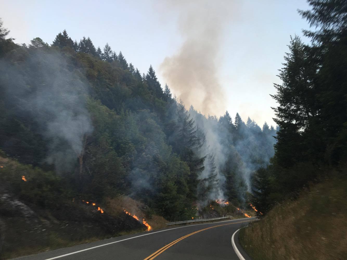
Wildfire season is the dominant factor in road availability. SR-299 serves as a critical fire line for the Shasta-Trinity National Forest. In the event of a nearby fire, the road may be closed to civilian traffic to allow for the movement of heavy "strike teams" and water tenders. Additionally, smoke density can reduce visibility to less than 50 feet in the canyon sections, forcing safety closures even if the fire is not directly on the pavement.
Commercial Vehicle and RV Specifications
For 2026, there are specific technical restrictions that drivers of over-length vehicles must adhere to. Failure to follow these can result in the vehicle becoming "stuck" in tight turns, leading to a full highway closure and significant fines.
- Kingpin-to-Rear-Axle (KPRA) Limits: Large semi-trucks are restricted on certain segments of 299. Specifically, the segment between Blue Lake and Willow Creek has a recommended KPRA limit of 30 feet.
- Advisory for RVs: Motorhomes over 35 feet are discouraged from using the 299 corridor during inclement weather or during periods of active one-way traffic control due to the narrow shoulder widths in the Trinity Canyon.
Emergency Equipment Standards
Mandatory Winter Carry Between November and April, all vehicles should carry "traction devices" regardless of 4WD/AWD status. California law requires these be in the vehicle for passage through chain control zones.
Communication Dead Zones Cellular service is non-existent for approximately 60% of the route between Weaverville and Willow Creek. Travelers should download offline maps and inform a third party of their Expected Time of Arrival (ETA) in Arcata or Redding.
Comparison: Route 299 vs. Alternative Detours
If Highway 299 is closed, travelers must choose between significant detours to reach the coast from the North State.
- Highway 36 (The Southern Route): From Red Bluff to Fortuna. While scenic, Highway 36 is significantly more winding and narrow than 299. It is not recommended for large trailers or those prone to motion sickness. In 2026, it remains a "last resort" detour.
- Highway 20 (The Clear Lake Route): From Williams to Fort Bragg/Ukiah. This is the safest and most reliable alternative but adds approximately 3 to 4 hours to the trip from Redding to the Humboldt coast.
- Interstate 5 to Oregon (The Northern Route): Taking I-5 north to Grants Pass and then Highway 199 to Crescent City. This is often the fastest detour if 299 is closed due to a landslide in the Trinity Canyon, provided the Smith River Canyon (Hwy 199) is also clear.
Step-by-Step Status Check Protocol
Follow this procedure before departing Redding for the coast in 2026 to ensure you do not encounter a "Hard Closure" mid-route.
- Check the QuickMap App: Look specifically for the "red circle with a white bar" icon indicating a full closure.
- Verify Chain Controls: If the temperature in Redding is below 45°F, check the status of Buckhorn Summit. If chains are "Required" and you do not have them, the road is effectively closed to you.
- Review the Caltrans CCTV Cameras: View the live camera feeds at Berry Summit and Weaverville to visually confirm weather conditions and traffic flow.
- Confirm Fuel and Supplies: Ensure you have a full tank of fuel before leaving Weaverville (heading west) or Willow Creek (heading east), as there are no services for nearly 40 miles in the heart of the canyon.
Expert Insight: Navigating the 2026 "Active Slide" Areas
As a Senior Technical SEO Strategist and regional logistics expert, I recommend that travelers avoid the 299 corridor during the first 24 hours of any major 2026 storm event. The "first flush" of rain often triggers rockfalls that Caltrans crews need time to clear. If you are traveling for business or a medical appointment on the coast, always allow a 90-minute buffer for one-way traffic delays, which are a near-constant reality due to the "2026 Bridge Rehabilitation Initiative" currently impacting the Douglas City and Junction City spans.
Frequently Asked Questions
Is Highway 299 open right now?
Road status changes hourly; you must check the Caltrans QuickMap or call 1-800-427-7623 for the immediate legal status. Generally, the road remains open unless a significant landslide or wildfire is actively impacting the Trinity River Canyon or the high summits.
Are chains required on Highway 299 today?
Chain requirements are common at Buckhorn Summit and Berry Summit during the winter months of 2026. If a storm is present, expect R1 (snow tires) or R2 (chains required on all vehicles except 4WD with snow tires) conditions at elevations above 2,500 feet.
How long does it take to drive from Redding to Arcata in 2026?
Under ideal conditions, the drive takes approximately 2.5 to 3 hours. However, due to standard 2026 maintenance schedules and one-way traffic controls, most travelers should plan for a 3.5-hour journey to reach the coast safely.
Is Highway 299 safe for large RVs and trailers?
While Highway 299 is a major trucking route, it features steep grades (up to 6%) and numerous sharp curves. RV drivers should be experienced with mountain driving and check for "Length Advisories" on the Caltrans website before attempting the route, particularly the stretch near Berry Summit.
What is the best detour if Highway 299 is closed?
The most reliable detour is usually taking Highway 20 through Clear Lake, though it is significantly longer. For those in North Redding, taking I-5 north to Highway 199 via Grants Pass is often a more efficient alternative to reach the northern coast.
For those planning to transit between the valley and the Pacific, staying informed via digital tools is the only way to ensure a seamless trip. Plan ahead, respect the mountain terrain, and always carry emergency supplies when crossing the Trinity Alps.