Accurate marine planning in Palm Beach County requires precise data, and consulting the official Jupiter FL tide tables for 2026 is essential for safe navigation, successful offshore and inshore fishing, and coastal recreation. Jupiter Inlet connects the Atlantic Ocean with the Loxahatchee River and the Intracoastal Waterway (ICW), creating dynamic hydrological conditions characterized by swift currents, shifting shoals, and pronounced tidal swings. Whether you are navigating the complex channel near the Jupiter Inlet Lighthouse, planning a bridge transit, or targeting snook and tarpon around the local flats, understanding how to read and apply these harmonic tide predictions is critical for safety and efficiency on the water.
Understanding Tidal Dynamics at Jupiter Inlet
The geographical configuration of Jupiter, Florida, creates unique hydraulic behaviors that differ significantly from open ocean coastlines. The Jupiter Inlet is a narrow, heavily managed channel flanked by jetties, which funnels massive volumes of water between the Atlantic Ocean and the Loxahatchee River estuary system during every tidal cycle.
Semidiurnal tides—meaning two high tides and two low tides each lunar day—are standard along this stretch of the southeast Florida coast. However, local meteorological conditions frequently override astronomical predictions. Cold fronts during the winter and spring push water levels down regardless of the tide chart, while easterly wind swells stack water against the coast, raising actual water levels above predicted heights.
Crucial Navigation Safety Warning: Tidal currents running through the Jupiter Inlet can exceed 4 to 5 knots during peak spring tides. Navigating vessels through the inlet during an outgoing (ebb) tide against a strong easterly wind creates standing waves, steep chop, and dangerous breaking seas known locally as the inlet washing machine. Mariners must cross-reference tide tables with real-time wind and swell forecasts before attempting passage.
2026 Tidal Characteristics and Seasonal Variations
The year 2026 brings standard astronomical alignments, including significant perigean spring tides (often called king tides) that occur during specific autumn and spring new and full moons. During these periods, low-lying coastal areas along the Indian River Lagoon, the ICW, and the lower Loxahatchee River experience minor tidal flooding, particularly when compounded by seasonal sea-level anomalies.
To effectively plan marine activities in Jupiter FL, boaters and anglers must understand the time offsets between the standard reference station at Lake Worth Inlet and the various secondary check points within the Jupiter waterway system.
| Location / Checkpoint | High Tide Time Offset (from Lake Worth) | Low Tide Time Offset (from Lake Worth) | Mean Tidal Range (Feet) |
|---|---|---|---|
| Jupiter Inlet (Jetty) | +0 hours 12 minutes | +0 hours 15 minutes | 2.5 to 3.0 |
| Loxahatchee River (Railroad Bridge) | +1 hours 05 minutes | +1 hours 25 minutes | 1.8 to 2.2 |
| Jupiter Sound (North ICW) | +0 hours 45 minutes | +0 hours 52 minutes | 2.0 to 2.4 |
| Southwest Fork (Loxahatchee) | +2 hours 15 minutes | +2 hours 40 minutes | 1.0 to 1.5 |
Note: Tidal ranges diminish rapidly as you move upstream into the freshwater reaches of the Loxahatchee River due to freshwater discharge flows from the Riverbend Park area and water control structures.
Strategic Applications for Anglers and Boaters
Mastering the 2026 Jupiter FL tide tables unlocks superior angling success and operational safety. Gamefish such as snook, redfish, tarpon, and spotted seatrout rely heavily on moving water to ambush prey swept along by the currents.
- Inshore Flats and Mangrove Creeks: Target outgoing tides as shrimp, crabs, and baitfish are pulled from the mangrove roots and shallow flats into deeper channels. Position your vessel down-current of structure, bridge pilings, or docks to present live baits naturally.
- Jupiter Inlet and Jetty Fishing: Incoming tides bring clean, high-salinity Atlantic water into the inlet, activating pelagic species like Spanish mackerel, bluefish, and jacks. Target the edges of the rips and eddy lines where current seams concentrate feeding fish.
- Sandbar and Recreation Planning: Popular local spots like the Jupiter Sandbar near the inlet experience dramatic depth changes. Low tide exposes large sandbars, making navigation tricky outside the marked channels, while high tide provides ample depth for anchoring and paddle sports.
Comparative Analysis of Marine Navigation Resources
Relying solely on printed static tide tables can lead to navigational errors due to rapid weather shifts in South Florida. Modern mariners utilize a combination of digital applications, physical charts, and official NOAA data sources.
| Resource Type | Primary Advantages | Limitations / Risks | Best Use Case |
|---|---|---|---|
| NOAA Tide Predictions (Official) | Highly accurate baseline astronomical data, free, scientifically verified. | Does not account for localized wind, barometric pressure, or tropical storms. | Baseline voyage planning and long-term scheduling. |
| Marine GPS / Chartplotters | Integrates tide data directly with real-time bathymetry and hazard marking. | Requires regular software updates; hardware battery dependency. | Active navigation through Jupiter Inlet and ICW channels. |
| Smartphone Fishing Apps | User-friendly interfaces, wind integration, community catch reports. | Inconsistent data parsing; subscription fees for advanced tidal currents. | Quick reference for inshore fishing and recreational planning. |
| Printed Tide Booklets | No power requirements; reliable backup in emergency electrical failures. | Fixed data that cannot adapt to real-time meteorological anomalies. | Mandatory onboard redundancy safety equipment. |
Step-by-Step Guide to Calculating Real-Time Water Levels
Because local winds and atmospheric pressure heavily influence Jupiter waters, calculating real-time depth requires more than just reading the printed chart. Follow this systematic approach to determine exact clearances under bridges and over shallow flats:
- Retrieve Baseline Data: Locate the official predicted high and low tide times and heights for the Jupiter Inlet for the specific date in 2026.
- Check Barometric Pressure: Note current atmospheric pressure readings. A drop of 1 inch of mercury (Hg) due to a passing storm or frontal boundary can raise coastal water levels by approximately 13 inches above astronomical predictions.
- Evaluate Wind Velocity and Direction: Strong sustained winds from the east or northeast push water into the Jupiter Inlet, increasing high tide heights and dampening low tides. Offshore westerly winds produce the opposite effect, resulting in lower-than-predicted water levels.
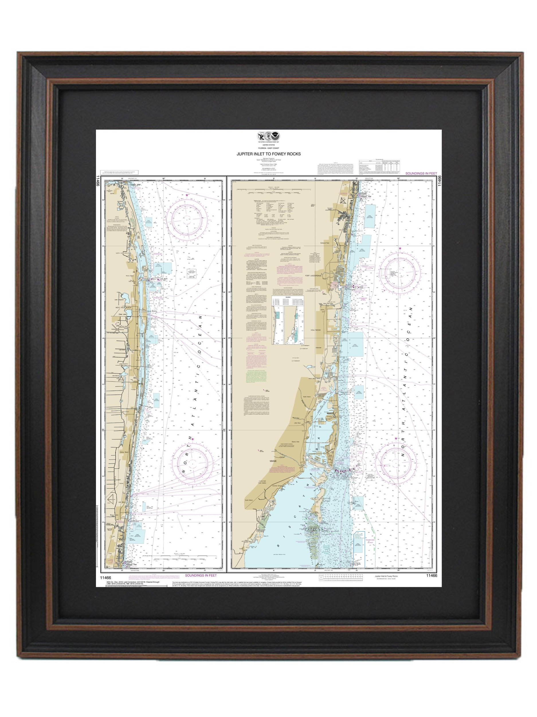
- Apply Depth Calculations: Add the predicted tide height (or adjusted height based on weather) to the mean low water (MLW) depth printed on your NOAA nautical chart (Chart 11472) to find the actual real-time depth.
Frequently Asked Questions About Jupiter FL Tides
What is the average tidal range at the Jupiter Inlet?
The average tidal range at the Jupiter Inlet is approximately 2.5 to 3.0 feet during normal astronomical conditions, though this range varies slightly depending on the lunar phase and seasonal solar alignment. This moderate range generates swift currents through the narrow inlet channel, requiring attentive boat handling.
How do I account for wind when using Jupiter tide tables?
Persistent easterly winds push water against the coast, causing actual high tides to run higher than predicted and preventing low tides from fully receding. Conversely, strong offshore winds blow water out of the estuary, resulting in lower low tides that can strand shallow-draft vessels on sandbars.
Are tide times at the Jupiter Inlet the same as Lake Worth Inlet?
No, while they are geographically close, high and low tides at the Jupiter Inlet occur slightly after Lake Worth Inlet due to coastal propagation lag. Mariners should apply a positive time offset of approximately 10 to 15 minutes when adapting regional Palm Beach County tide charts to Jupiter waters.
How do king tides impact Jupiter, Florida in 2026?
King tides in 2026 will cause temporary minor coastal flooding during peak autumn full and new moons, particularly in low-lying residential areas along the Loxahatchee River and the Intracoastal Waterway. Property owners and drivers should monitor local advisories during these peak astronomical events.
Where is the best place to check real-time current speeds for the Jupiter Inlet?
Real-time current flow and wind data can be monitored via NOAA physical oceanographic real-time systems (PORTS) covering the Palm Beach and Jupiter region, combined with visual checks of the surface chop and marker buoys at the inlet entrance.
Secure Your Marine Adventures Today
Accurate planning is the foundation of every safe and successful day on the water in Palm Beach County. Always verify current weather bulletins, cross-reference the 2026 Jupiter FL tide tables before departure, and ensure all safety gear meets Coast Guard requirements. For personalized local insights, marina slip reservations, or professional guide services, consult local Jupiter marine experts and tackle outfitters before casting off.