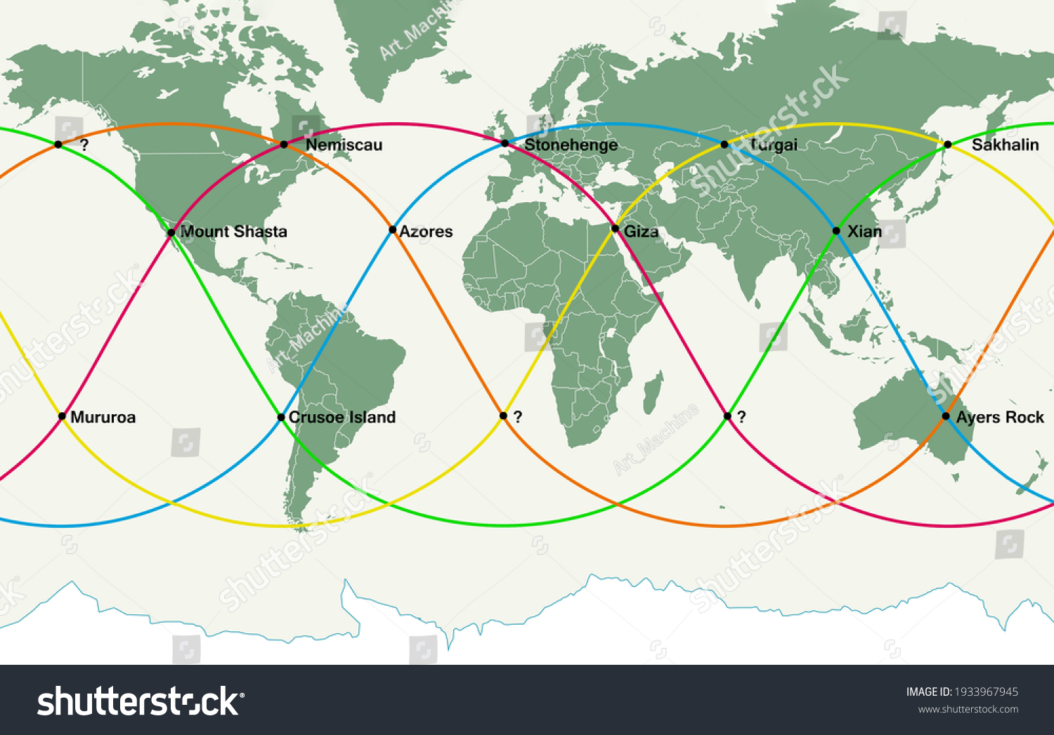
The concept of ley lines—hypothetical straight alignments drawn between various historical structures, sacred sites, and geographical landmarks—continues to capture the imagination of modern explorers, researchers, and alternative historians. As interest in esoteric geography, archaeoastronomy, and immersive experiential travel grows through 2026, understanding how these invisible grids are interpreted across North America requires a balanced look at folklore, topography, and cultural geography.
Defining the Phenomenon: From Alfred Watkins to Modern North American Geodesy
The term "ley line" was coined in 1921 by amateur English archaeologist Alfred Watkins in his book The Early British Trackways. Watkins hypothesized that ancient British roadways followed straight visual alignments from hill to hill, connecting prehistoric monuments, churches, and mounds. While mainstream archaeology largely attributes these European alignments to coincidence or practical ancient surveying techniques utilizing line-of-sight, the concept evolved dramatically when it crossed the Atlantic.
In North America, the term was co-opted by twentieth-century occultists, New Age researchers, and earth mystery enthusiasts who expanded Watkins' original idea beyond physical pathways. In the North American context, ley lines are frequently described as global energy currents, telluric currents, or geometric grids connecting Indigenous mounds, sacred mountains, modern metropolitan centers, and geological anomalies.
Core Components of North American Ley Line Theories
- Indigenous Mounds and Earthworks: Many theorists point to the alignment of monumental mound-building cultures, such as Cahokia in Illinois or the Serpent Mound in Ohio, as anchor points for continent-spanning grids.
- Topographic and Geological Alignment: Major mountain ranges, such as the Rocky Mountains and the Appalachian chain, are frequently integrated into hypothetical regional fault-line and energy grids.
- Modern Architecture and Infrastructure: Proponents often draw connections between ancient sites and modern monuments, government buildings, or historical grid layouts in major cities like Washington, D.C.
Major Hypothetical Alignments and Regional Hotspots
North America's vast geography hosts numerous localized and transcontinental alignments proposed by researchers and enthusiasts. While mainstream geographers and geologists emphasize that any set of random points on a map can be connected with a straight line due to sheer mathematical probability, the cultural and tourism footprint of these locations remains undeniable.
Prominent North American Alignment Zones
| Region / Alignment Name | Associated Landmarks | Primary Hypothesized Significance |
|---|---|---|
| The Serpent-Cahokia Axis | Serpent Mound (OH), Cahokia Mounds (IL), Native Earthworks | Connects major Mississippian and pre-Columbian ceremonial centers along a longitudinal corridor. |
| The Four Corners Vortex | Monument Valley, Chaco Canyon, Mesa Verde | Integrates ancestral Puebloan cliff dwellings with high-altitude desert energy nodes. |
| The Atlantic Seaboard Line | St. Augustine (FL), Savannah (GA), Washington D.C., Boston (MA) | Links early colonial settlements, revolutionary historic sites, and key governmental architecture. |
| The Cascade Volcanic Alignment | Mount Shasta, Crater Lake, Mount Rainier, Mount Hood | Follows the Pacific Ring of Fire volcanic chain, frequently associated with high-energy tectonic folklore. |
Scientific Skepticism Versus Cultural Significance
Evaluating North American ley lines requires navigating a distinct gap between empirical earth sciences and metaphysical folklore. Understanding both perspectives provides a well-rounded context for travelers, historians, and researchers navigating these landscapes in 2026.
Comparative Analysis of Perspectives
Mainstream Scientific Viewpoint Statistical Probability: Mathematicians have demonstrated that any dense collection of geographical points will inevitably yield straight-line alignments purely by chance, akin to dropping pins on a map. Lack of Empirical Measurement: Instruments designed to measure electromagnetic fields or telluric currents show no anomalous or directional energy grids corresponding to traditional ley line maps. Functional Archeology: Structures like indigenous mounds and ancient roads served practical, defensive, agricultural, or ritualistic purposes tied to immediate topography rather than global geodetic grids.
Alternative and Cultural Perspective Landscape Perception: Indigenous and traditional cultures worldwide developed sophisticated relationships with their environments, often recognizing powerful topological features that modern societies map as sacred sites. Experiential Tourism: Exploring these alignments drives significant cultural heritage tourism, encouraging visitors to deeply engage with regional history, paleontology, and conservation. Psychogeography: The practice of walking or studying alignments offers a unique framework for interacting with the landscape, blending art, history, and personal introspection.
Practical Field Guide: Exploring North American Earth Mysteries Responsibly
For those interested in visiting historical and geological sites associated with ley line theories across North America, a structured, respectful approach ensures both personal safety and the preservation of sensitive heritage areas.
- Research Site Access and Permissions: Many historical mounds and sacred Indigenous sites are protected under federal, state, or tribal laws. Always check official access guidelines and respect restricted zones.
- Prioritize Historical Context: Supplement esoteric literature with rigorous local history, archaeology, and tribal oral histories to understand the true human narrative of the land.
- Practice Leave No Trace Principles: High-traffic natural landmarks often experience environmental strain. Pack out all waste, stay on marked trails, and avoid disturbing geological or archaeological formations.
- Engage with Local Guides: Whenever possible, support local indigenous cultural centers, museums, and park rangers who offer authentic interpretations of regional geography and history.
Frequently Asked Questions About Ley Lines in North America
What are ley lines in North America?
Ley lines in North America are hypothetical straight alignments connecting ancient earthworks, geological anomalies, and cultural landmarks, interpreted by enthusiasts as global energy grids. Mainstream science attributes these alignments to mathematical coincidence rather than physical energy channels.
Are there any scientific instruments that can detect ley lines?
No, standard geophysical instruments such as magnetometers and electrometers find no evidence of anomalous energy corridors or global grids corresponding to traditional ley line maps.
Which North American sites are most commonly associated with ley line theories?
Popular locations include the Cahokia Mounds in Illinois, Serpent Mound in Ohio, Chaco Canyon in New Mexico, and Mount Shasta in California. These sites hold deep historical, ecological, and cultural significance regardless of esoteric theories.
How can travelers safely explore these historical regions in 2026?
Travelers should respect tribal sovereignty and protected lands, adhere strictly to environmental conservation rules, and rely on verified historical and geological resources alongside alternative guidebooks.
Is the concept of ley lines recognized by mainstream archaeology?
Mainstream archaeology rejects the idea of a global energy grid, viewing ancient alignments as coincidental or as the result of practical surveying methods utilized by historical civilizations for roads and line-of-sight communication.
Conclusion: Navigating Myth and Geography
The enduring fascination with ley lines in North America highlights a profound human desire to connect disparate parts of our vast continent into a meaningful whole. Whether approached as an exercise in imaginative geography, a framework for heritage tourism, or a study in human pattern recognition, exploring these landscapes invites a deeper appreciation for the complex interplay between human history and the North American terrain. Plan your next educational journey by grounding your exploration in historical respect, environmental stewardship, and scientific curiosity.